Skip to content

ELCV logoCaring For Our Countryside
Scottish Charity SC044495

ELCV

East Lothian Countryside Volunteers

Search
  • Home
  • News
    • ELCV
    • Other
  • Groups
    • Summary
    • Aberlady
    • Dunbar
    • Junior Rangers
    • Levenhall Links
    • North Berwick
    • Path Wardens
    • Pencaitland
    • Pony/Sheep Checkers
    • Yellowcraig
  • Tasks
    • Summary
    • Infrastructure
    • Invasive Plants
      • Giant Hogweed Eradication Programme
        • Hogweed Maps
        • Hogweed Surveys
          • Install Gaia
          • Survey Detailed Instuctions
        • Hogweed End-of-Year Reports
          • 2020 Report
          • 2021 Report
          • 2022 Report
          • 2023 Report
          • 2024 Report
    • Litter
    • Path Wardening
    • Pony/Sheep Checking
    • Survey Wildlife
  • Charity
    • Summary
    • Business Plan
    • Trustees
      • Trustees Only
    • Meetings
    • Finance
  • Library
    • Summary
    • Policies
      • Cookie Policy
      • Privacy Policy
    • Projects
      • Core Path 327
      • Gifford – Morham
    • Paths
      • Forth to Farne Way – Ideas
    • Path Reports
    • Crosswords
  • FAQ
  • Contacts
  • Links
  • Search

Forth to Farne Way – Ideas

Overview

Click on a Section
Download as KML
Download as GPX
Using the Map

……..

Some text explaining

maybe a picture

or whatever

or whatever

See below for different sections

Download as KML
Download as GPX

Click anywhere to view more details

Pages: 1 2 3

Email Share Tweet Follow Print
Site Map  Privacy  Follow us   Contact us

© 2025 ELCV • Powered by GeneratePress
Scroll back to top


🎵What to Record?

We want to record all the details we can, to help the landowner find them,  and to monitor our overall progress:
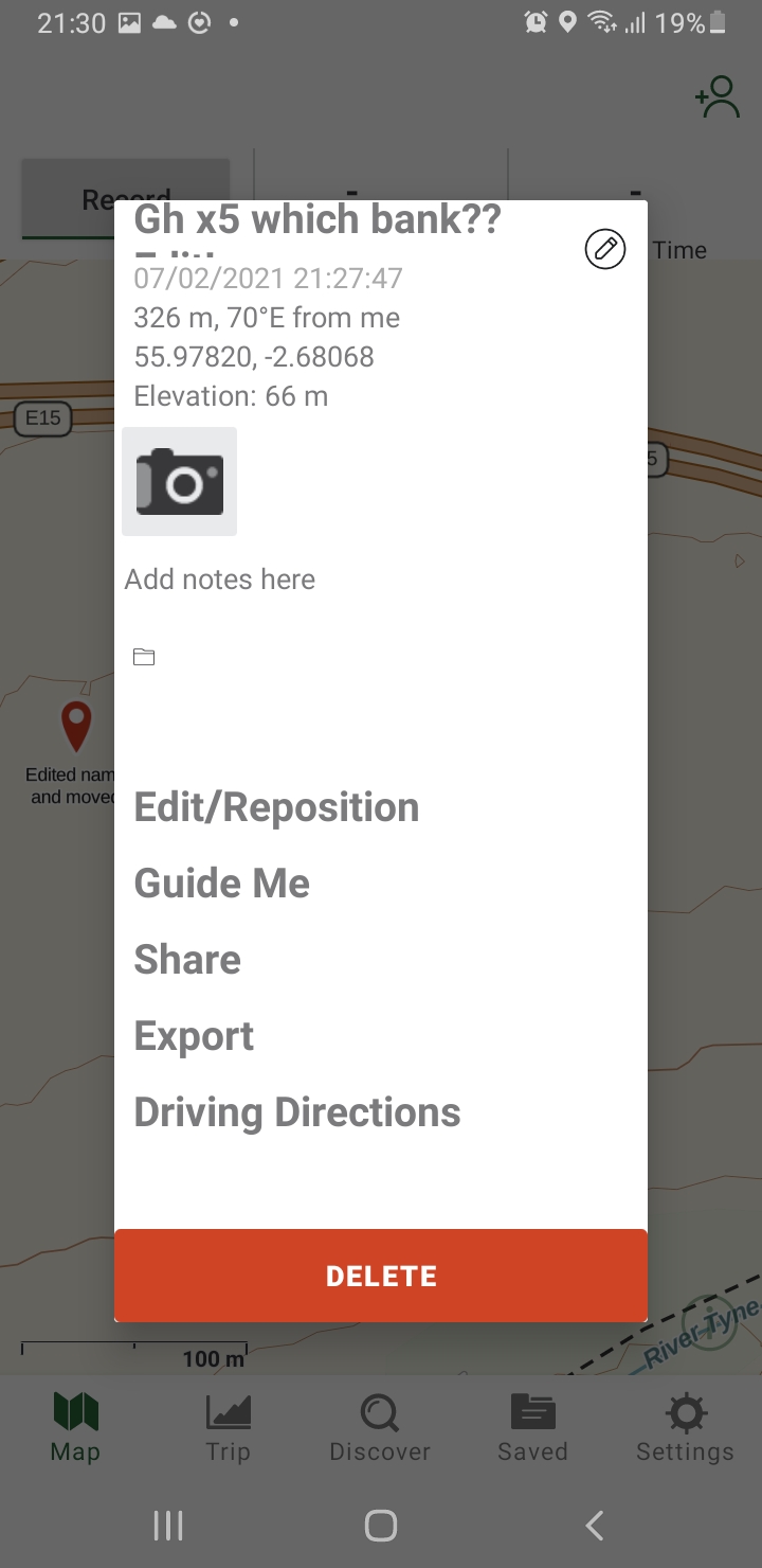
  • Plant
    • GH for Giant Hogweed
    • JK for Japanese Knotweed
    • HB for Himalayan Balsam
  • Quantity
    • eg x5
    • For JK/HB estimate the area, eg 20sqm
  • Status
    • eg small, medium, large, flowering (hopefully not!)
  • Bank
    • Which side of the river its on, eg left bank (looking downstream)
  • Your initials, eg DQ
  • Any other useful info (if long, put in Notes), e.g.
    • Under tree; Hidden in bushes; opposite gate
    • looks sprayed
    • still not been treated despite 2 previous reports
    • Dead, but has full seed head – must have been missed last year
  • NB: Timestamp is automatic
    • Location, Date & Time get automatically recorded & exported by the software

Examples

  • GH x5 3ft left bank hidden in willows. DQ
  • GH x1 flowering in woods off right bank. Reported in April but still there!
  • JK 30sqm island by West Bank. Look as if sprayed
  • Couldnt survey 20m upstream of here, too overgrown. DQ
  • Started/Ended my Spring survey here
How to browse the map

How to Browse:
* Zoom In/Out:  bottom left
* More Detail:    Click on an icon
* Move Around: Click & Drag
* Full Screen:      top right
* Show Legend:  top left
— Show/Hide Layer: /
— Show All Items :     /
— Satellite View:     /(at end)

Saved Filter

Currently only Android screens are included in pop-ups. iPhone screens will be added in the future, I am sure!

Track Email (eg GMail)

Export Menu

Track Menu


Waypoint Menu & Edit/Reposition


Add Menu

Track Menu

Enter Waypoint Details

Track Menu